Archival Campus Map from 1950s Featured on Admissions Brochure
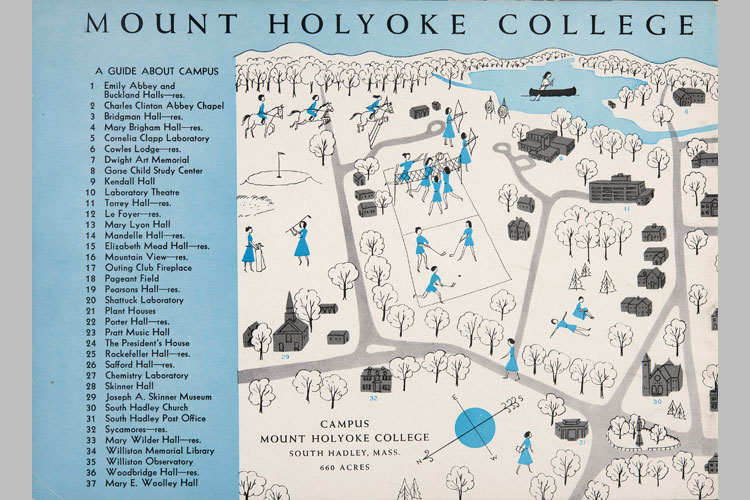
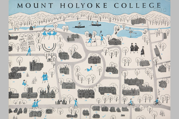
This Mount Holyoke campus map—the outside cover of a 1950s admission brochure—was hand illustrated and showed not only the layout of campus buildings and roads but also people interacting in the space. Figures are shown skating on Lower Lake, riding horses, relaxing on Skinner Green, and even donning graduation robes.
While the map depicts a campus recognizable as the one we know and love, close viewers will note changes over the past seventy-five years. Text reveals that campus was 660 acres, compared to the eight hundred of today. Other differences include the residences of Bridgman Hall, Cowles Lodge, Le Foyer, Mountain View, Sycamores, and Woodbridge Hall—none of which are used as student residence halls today (and a few of which are no longer standing).
—By Sara Rottger ’19
Keep up with Mount Holyoke Archives and Special Collections at mhc-asc.tumblr.com or follow them on Instagram and Snapchat at mhcarchives and on Twitter @ASCatMHC.
This article appeared as “A Visual Guide” in the winter 2018 issue of the Alumnae Quarterly.
January 11, 2018


Leave a Reply